This Mississippi Bridge Turns 30 Degrees Midstream. River Pilots Made It Bend.
Revised November 13, 2026
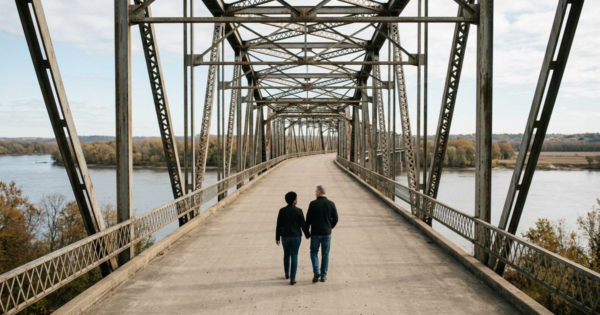
Can you walk across the Old Chain of Rocks Bridge?
Yes. The Old Chain of Rocks Bridge is open to people walking and biking, not cars. Most people start at Chain of Rocks Park, 10840 Riverview Drive on the Missouri side, where the park opens at 7 a.m. The round trip from the park to the Chouteau Island trailhead in Illinois and back is 2.1 miles, with a 30-degree bend halfway across.
Keep reading ↓Thirty degrees. That’s how hard the deck turns halfway across, more than 60 feet above the Mississippi, and you feel it before you see it: the line of steel trusses swinging off to the left while the wind comes up the river and pushes at your jacket. River pilots put that turn there. Below, the water slides past brown and fast, breaking white over the rock line south of the bridge. People stop right here, at the bend, phones up.
The bend wasn’t its only close call. After the bridge closed, the National Park Service says, it deteriorated, and during the 1970s Army demolition teams considered blowing it up just for practice. In 1975, demolition seemed imminent. Then, in the Park Service’s words, a bad market saved the day: the value of scrap steel plummeted, making demolition no longer profitable.
That’s it. That’s why you can walk it. Not a preservation campaign, at first. A falling price. The bridge entered what the Park Service calls 20 years of bridge limbo, too expensive to tear down, too narrow and outdated to carry modern vehicles, and it was still standing when the trail people came for it.
Can you walk across the Old Chain of Rocks Bridge?
Yes. The Old Chain of Rocks Bridge is open to people walking and biking, not cars. Most people start at Chain of Rocks Park, 10840 Riverview Drive on the Missouri side, where the park opens at 7 a.m. The round trip from the park to the Chouteau Island trailhead in Illinois and back is 2.1 miles, with a 30-degree bend halfway across.
The Park Service describes it as a mile-long bridge more than 60 feet above the Mississippi, and from the deck that height is the thing you notice. Barges look small. The far shore looks farther than a mile. There’s no shade on the deck, so the sun and the wind both find you, and on a cold morning your fingers go stiff on the phone before you get the bend in frame.
Before you go, check the alert at the top of Great Rivers Greenway’s Chain of Rocks Park page. It currently says the Chain of Rocks canal bridge in Illinois is closed for construction, with no detour or construction end date provided, so the old bridge is open and accessible from the Missouri side only. That makes the Missouri park your way on, and the walk an out-and-back.
The park’s own posted hours open at 7 a.m. every day and close with the seasons: 6:30 p.m. after daylight saving time ends, 7:30 p.m. once it begins, and 9 p.m. starting April 1. In winter that leaves a short window, so go early. The lot holds 55 spaces, including 3 accessible ones, and there’s no overnight parking.
Why does the bridge bend in the middle?
Because the river pilots pushed back, and the rock said no. According to the Park Service, riverboat men protested the planned bridge because it was to run near two water intake towers for the Chain of Rocks pumping station. Navigating the bridge piers and the towers at the same time, the captains argued, would be extremely treacherous for vessels and barges. And the first straight line would have put the bridge over a section of river where the bedrock couldn’t support the weight of the piers.
Either way, as the Park Service puts it, the bridge had to bend. Stand at the turn and look downstream for the intake towers the pilots worried about. They’re the reason your photo has a corner in it.
The name is older than the bridge. The Park Service says it came from a 17-mile shoal, a series of rocky rapids called the Chain of Rocks, beginning just north of St. Louis. In the 1960s the Corps of Engineers built a low-water dam covering the Chain of Rocks, which is why you can’t see the original ledges today. The white water you hear from the deck is that dam doing its work.
Before the dam, the Park Service says, multiple rock ledges just under the surface made this stretch of the Mississippi extremely dangerous to navigate. Look down from the bend at the churn below and you can still feel why the pilots were nervous about anything else in the channel.
Winter brings the eagles
Here’s the part locals keep to themselves. The Missouri Department of Conservation says the Chain of Rocks rapids to the south of the bridge create open water, ideal fishing water for eagles, and the department has run eagle viewing at the center of the bridge, a half-mile walk from each entrance. Cold days, open water, fish. The eagles do the math.
So bring binoculars when it’s cold, scan the big trees along the banks, and watch the open water below the rock line. Dress warmly. The wind on that deck in January doesn’t care how good your coat looked in the car.
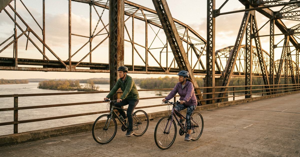
Why didn’t they tear down the Chain of Rocks Bridge?
Money, twice. The first time, money built it, and more of it than planned. The Park Service says the piers were complete by August of 1928 and a grand opening was planned for New Year’s Day 1929, but floods and ice slowed the work, and the bridge finally opened to traffic in July of 1929. It cost just over $2.5 million, twice its original estimate.
The Park Service says the public got its money’s worth. A park-like setting around a pool and a large, ornate toll booth anchored the Missouri end. On the Illinois side, 400 elm trees lined the approach, and the bridge brought travelers into St. Louis by way of the Chain of Rocks amusement park. Stand where the Missouri trail meets the deck and try to see it: the pool, the ornate toll booth, the Route 66 traffic lining up to pay and cross.
It became an official part of the Route 66 experience in 1936, when the highway was rerouted over the bridge. During World War II, the bridge’s red sections had to be painted green to make it less visible from the air. Gas rationing cut traffic at the same time, so the City of Madison raised tolls to 35 cents per car, with an additional five cents per passenger. Read that again. Every friend you brought along cost you extra.
The second time, money nearly killed it. In 1967 the New Chain of Rocks Bridge carrying Interstate 270 opened just 2,000 feet upstream, and the old bridge closed in 1968. Then came the demolition teams, the scrap market that crashed, and the long limbo. In 1980, film director John Carpenter used the gritty, rusting bridge as a site for his science fiction film Escape from New York. Otherwise, the Park Service says, the bridge was abandoned.
Then the trail people found it. During the 1980s, greenways and pedestrian corridors became popular, and a group called Trailnet began cleanup and restoration of the bridge. It reopened to the public as part of the Route 66 Bikeway in 1999. Because it hasn’t been significantly altered over the years, the Park Service says, a visit today conveys a strong sense of time and place.
Walked this one already? See which other river crossings let you on foot in our guide to bridges in St. Louis
What to know before you walk it
The park rules are short and posted. Pets must be on a leash at all times, and owners must remove all solid waste. Glass containers and littering are prohibited, and so are open fires, charcoal grills, fireworks and water balloons. No unauthorized motorized vehicles are allowed on the bridge or the greenway. A drinking fountain with a water bottle refill and a pet drinking bowl are available on site from April to November, so bring your own water the rest of the year.
Coming from westbound I-270? The park page posts a detour while the westbound exit ramp to Riverview Drive is closed for construction: take the Lilac exit 33, the exit after Riverview Drive, turn right on Lilac Avenue for 235 feet, turn right on Dunn Road for 1.1 miles to Riverview Drive, then turn right, and the park is on your left. If that notice is gone from the page, the ramp is back.
Want more miles? The park page lists the distances from Chain of Rocks Park: 5.9 miles to the south end of North Riverfront Park and back, and 14.8 miles to the Lewis and Clark Confluence Tower and back. Our guide to the St. Louis Riverfront Trail covers the ride south.
If the Chain of Rocks Park lot is full, the park page also lists parking at North Riverfront Park, a north lot of 70 spaces and a south lot of 20. Park there and walk or ride north on the greenway to the bridge. It turns a short stroll into a real morning, with the river on one side the whole way.

Next time somebody calls it just a bridge, you’re the one who knows it was saved by a bad scrap market, that it bends because of two stone towers and soft bedrock, and that a carload of friends once paid extra to cross it. Pick a clear morning. Check the park page. Walk out to the bend and listen to the rapids.
Keep the day going:
- historic sites in St. Louis
- underrated places to visit in St. Louis
- things to do in Eureka, MO
- scenic drives around St. Louis
- small towns outside St. Louis
- things to do in Granite City, IL
- parks in Alton, Illinois
- Columbia Bottom Conservation Area
- where the Missouri and Mississippi rivers meet
- the St. Louis riverfront
Off the bridge and hungry? Our guide to where to eat in North County, MO picks up a short drive from Riverview Drive.
If you run a kitchen, a bike shop or a bait shop near Riverview Drive, the people walking off this bridge are cold, hungry and looking at their phones for the closest place to sit down. List your business with us and turn that walk into customers.
Frequently asked questions
Is the Chain of Rocks Bridge open?
Yes, to people walking and biking. Great Rivers Greenway’s park page currently says the bridge is open and accessible from the Missouri side only, because the Chain of Rocks canal bridge in Illinois is closed for construction. Check that page before you go.
Why is Chain of Rocks Bridge closed?
The bridge closed in 1968, after the New Chain of Rocks Bridge carrying Interstate 270 opened 2,000 feet upstream, and it reopened to the public as part of the Route 66 Bikeway in 1999. Today any closure notice is usually about the approach roads, so check Great Rivers Greenway’s park page.
When did they close the Old Chain of Rocks Bridge?
In 1968. The New Chain of Rocks Bridge carrying Interstate 270 opened in 1967, and the old bridge closed the next year. It reopened to the public as part of the Route 66 Bikeway in 1999.
Can you drive over the Chain of Rocks Bridge?
No. No unauthorized motorized vehicles are allowed on the bridge or the greenway. The New Chain of Rocks Bridge carrying Interstate 270 opened just 2,000 feet upstream in 1967. The old deck now belongs to the people on foot and on bikes, and the Park Service says the bridge is open to bikers and pedestrians daily.
How long does it take to walk the Chain of Rocks Bridge?
The round trip from Chain of Rocks Park to the Chouteau Island trailhead and back is 2.1 miles, and the middle of the bridge is a half-mile walk from each entrance. Add time for the photo at the bend.
What movie was filmed on the Chain of Rocks Bridge?
Escape from New York. In 1980, film director John Carpenter used the gritty, rusting bridge as a site for his science fiction film. At the time, the bridge was in what the Park Service calls 20 years of bridge limbo, too expensive to tear down and too narrow and outdated to carry modern vehicles.
Does the Chain of Rocks Bridge still exist?
Yes. Demolition seemed imminent in 1975, but the value of scrap steel plummeted, making demolition no longer profitable. The bridge reopened to the public as part of the Route 66 Bikeway in 1999.

Written by a dedicated team of St. Louis locals who live, work, and play right here in the St. Louis metro. Founder Lane Forman and team are committed to building the region’s most trusted directory by verifying listings and connecting local businesses with loyal customers across Missouri and Illinois.