Things to Do in Elsberry, MO: Ted Shanks, Clarence Cannon Refuge, Snow Geese
Revised October 10, 2026

What is Elsberry, Missouri known for?
Elsberry is the Lincoln County river town where Congressman Clarence Cannon was born in 1879 and buried in 1964, with a sitting president at his funeral. It sits at the edge of the Mississippi floodplain, with the wetlands of B.K. Leach Conservation Area just south and the free Clarence Cannon National Wildlife Refuge about 10 miles north.
Keep reading ↓Ever wonder why every eagle-watching list sends St. Louis across the river to the same Illinois bluffs? The lists copy each other. Meanwhile, on one day in December 2022, the U.S. Fish and Wildlife Service counted 77,076 ducks on a free federal refuge about 10 miles north of Elsberry, and on Feb. 13, 2023, its survey logged 30,000 snow geese on the same ground. Those counts come from the refuge’s 2022-23 season, which is the latest the agency has posted, so check its survey page for a newer table before you plan around them. None of the recycled lists mention the place.
The refuge is named for a man born in Elsberry in 1879. Clarence Cannon went on to serve 41 years in Congress, punched a fellow congressman in the face during a 1945 argument, and came home in 1964 for a funeral that brought a sitting president to a field outside town by helicopter. Hardly anyone connects the name on the refuge sign to a Lincoln County town of 1,937 people at the 2020 census. Farther up the same highway, Ted Shanks Conservation Area adds 6,705 acres of marsh, oxbow lakes and river bluffs that the eagle lists skip entirely.
Of all the small towns outside St. Louis worth a day, Elsberry is the one that sits between three public wetlands on the Mississippi Flyway. Everything below was checked against U.S. Fish and Wildlife Service, Missouri Department of Conservation, USDA and city pages in October 2026, and it’s sorted by what you came to see. Bring binoculars. Let everybody else fight over the Illinois pull-offs this winter.
What is Elsberry, Missouri known for?
Elsberry is the Lincoln County river town where Congressman Clarence Cannon was born in 1879 and buried in 1964, with a sitting president at his funeral. It sits at the edge of the Mississippi floodplain, with the wetlands of B.K. Leach Conservation Area just south and the free Clarence Cannon National Wildlife Refuge about 10 miles north.
Start with Cannon, because the town does. He was born on April 11, 1879, and Elsberry itself was surveyed and platted that August, so the boy and the town grew up together. His father ran a general store and later served as the town’s second mayor. Cannon became House parliamentarian, compiled the rulebook still known as Cannon’s Precedents, and chaired the House Appropriations Committee for about 19 years in all. He also had a temper. In 1945 he punched Rep. John Taber of New York during an argument, and years later he mocked the space program as a “moondoggle.”
When he died in May 1964, the funeral came home to the First Baptist Church in Elsberry. President Lyndon Johnson flew into St. Louis and took a helicopter to a field on the edge of town to join the motorcade. Former President Harry Truman came too. About 4,000 people filled the streets, some with lawn chairs, ladders and packed lunches. Cannon is buried in Elsberry City Cemetery, and visiting the grave costs nothing.
Then there’s the ground under the town. The 1888 county history put Elsberry “fifty-eight miles north of the city of St. Louis” on the old railroad, and it described two halves that people called “on the hill” and “under the hill.” The hill half sits on a bench of the bluffs, with what that history called a view of the Mississippi Valley and the hills on the Illinois side. The flat bottomland below the bluff is why the birds come. It’s also why two state conservation areas and a federal refuge line Highway 79 north and south of town.
What can you do at Ted Shanks Conservation Area?
Hike, fish, camp at a primitive site, watch birds and, in season, hunt ducks, on 6,705 acres where the Salt River runs into the Mississippi. It’s the biggest of the three wildlife areas on this stretch of Highway 79, and the longest drive on this page: about 45 road miles north of Elsberry, straight up Highway 79 and then east on Route TT. Fill the tank in town.
The land has a pedigree St. Louis should care about. Zebulon Pike charted the mouth of the Salt River in 1805. MDC says the area was a hunting and battle ground for the Sac and Fox from the north and the Osage from the south. In 1799 it was granted to a man named Saucier, and it passed from him to Auguste Chouteau, one of the founders of St. Louis, and then to Neree Valle, a name tied to the founding of Ste. Genevieve. The state bought it in 1970 and 1971, and a federal excise tax on guns and ammunition paid 75 percent of the original purchase.
What’s out there. The area borders 8.75 miles of Mississippi River frontage, 4.75 miles of the Salt River and 2.25 miles of river bluffs. Inside that line, MDC manages bottomland hardwoods, open marsh, oxbow lakes, sloughs, old fields and upland woods. It also runs plumbing most visitors never notice: 35 miles of levees, three pump stations, nine miles of canals and 45 water-control structures, split into 25 management units. That machinery lets the state flood fields on cue for migrating birds, and Visit Missouri puts the seasonally flooded acreage at about 4,000.
Hiking and the overlook. MDC lists hiking among the area’s uses, and its area map marks a hiking trail, a scenic overlook and a picnic area. Vehicles stay on the gravel and paved roads and in the parking lots, and the speed limit is 45 unless posted otherwise. Pick a clear morning and take the binoculars up to the overlook first.
Camping. Ted Shanks is one of the conservation areas where MDC allows camping, at designated sites. The statewide rules apply: no more than 14 consecutive days in any 30-day period, quiet hours from 10 p.m. to 6 a.m., and a special use permit for groups of more than 10. Seasonal closures can cover campsites too, so check the area map before you pack the tent.
Fishing. MDC lists white bass, sunfish, catfish, crappie and black bass. A concrete boat ramp drops into the Salt River, and the area holds more than 500 acres of fishable water, Horseshoe Lake among them. On lakes and ponds under 70 acres, only electric motors are allowed. On bigger water, outboards over 10 horsepower have to run at slow, no-wake speed.
Birds and other wildlife. MDC’s short what-to-look-for list for the area names the mallard, the bald eagle, white-tailed deer and the North American snapping turtle. In spring and fall, the managed units turn into a rest stop for whatever is moving up and down the river.
Hunting. Waterfowl hunting runs on a daily morning draw. Deer hunting is archery only, and the list also covers turkey, rabbit, squirrel, dove and quail. Shotgun hunters must use nontoxic shot. Lead is banned on the area.
The calendar that matters. Ted Shanks is open from 4 a.m. to 10 p.m. But portions close to protect waterfowl every year from Oct. 15 through March 1, and during duck season only authorized hunters may be inside the waterfowl shooting areas, where shooting ends at 1 p.m. MDC also posts a standing warning that the area floods, so check local conditions and never drive onto a flooded road. Call (573) 248-2530 before a long drive. If you’re reading this in early October, Oct. 15 is the date to circle. Go before it for the full run of roads, or after it for the birds and a view from the edges.
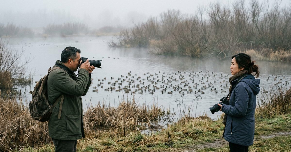
What can you see at Clarence Cannon National Wildlife Refuge?
Big flocks of ducks in late fall, geese through the winter, shorebirds in spring and nesting bald eagles, on 3,750 acres of Mississippi floodplain that cost nothing to visit. It’s about 10 miles north of Elsberry. Take Highway 79 north, then go one mile east on Pike County Road 206 to the headquarters at 37599 Pike 206. The refuge invites you to call ahead at (573) 847-2333 and ask what’s moving that week, so do it.
The U.S. Fish and Wildlife Service bought the land in 1964 with duck stamp money, the federal stamp waterfowl hunters buy every season, and named it for Cannon, who the agency says was “influential in its establishment.” It used to be farmland in an agricultural levee district, and all but a few hundred acres still sit behind a levee. The refuge’s job is narrow and stated plainly: a feeding and resting area for migratory birds. FWS says nearly 300 bird species use it during migration.
How to see it, by the clock. FWS gives visitors a time menu, and it’s a good one. With 15 minutes, stop at the headquarters and visitor contact station, finished in 2008, where exhibits tell the story of the Mississippi Flyway. With an hour, drive the auto route. With half a day or more, hike, bird or photograph. The nature trail is unpaved and open all year, unless it’s posted closed for weather or to protect eagles nesting nearby. A pair of bald eagles built the refuge’s first nest in 1991.
Hours and the fine print. Refuge lands, roads and trails are open from a half hour before sunrise to a half hour after sunset. The visitor contact station keeps weekday hours, 7:30 a.m. to 4 p.m., Monday through Friday except federal holidays, and it may close for flooding or winter weather. The only restrooms are inside, during those hours. Many parts of the refuge are reachable on foot only, and weather can ruin the roads, so dress for mud.
When to go: read the survey table. Refuge staff count birds through fall and winter and post the results online. As of October 2026, the latest season posted is fall 2022 through winter 2023. Treat these dated counts as a pattern, not a forecast for this year:
| Survey date | What the refuge counted |
|---|---|
| Oct. 3, 2022 | 12 ducks |
| Nov. 21, 2022 | 42,038 ducks |
| Dec. 6, 2022 | 77,076 ducks, including 39,152 mallards and 14,100 northern pintails |
| Dec. 13, 2022 | 7 adult bald eagles, 4 trumpeter swans and 2 sandhill cranes |
| Dec. 19, 2022 | 22,000 greater white-fronted geese |
| Dec. 27, 2022 | 1,100 ducks |
| Feb. 13, 2023 | 30,000 snow geese |
| March 27, 2023 | 2 common loons, an American white pelican, 2 black-necked stilts and 4 American golden-plovers |
Read it the way a fisherman reads a tide chart. In that season the ducks went from a dozen in early October to 77,076 on Dec. 6, 2022, then fell to 1,100 three weeks later. That’s a narrow window. If the pattern holds, late November and the first half of December are the duck weeks, and the geese hang around longer. Check the FWS survey page for a newer table before you go, because a wet fall or an early freeze can move everything.
One more surprise. This headquarters also runs two other refuges, Great River and Middle Mississippi River, and the Middle Mississippi refuge’s island divisions sit far downriver near Ste. Genevieve. A lot of the federal refuge land along this river is managed from a building on a county road north of Elsberry.
Where can you see snow geese near St. Louis?
At Clarence Cannon National Wildlife Refuge, on the Mississippi floodplain north of Elsberry, where the survey counted 30,000 snow geese on Feb. 13, 2023, the biggest snow goose count in the latest season the agency has posted. Here’s what that same survey says about timing, since snow geese don’t keep a schedule.
In the 2022-23 season, the first 2,000 snow geese showed up on the Nov. 29, 2022 count. The flock grew to 7,000 by Dec. 19, 2022, dropped off the count over the holidays, came back at 3,200 on Jan. 9, 2023, and then hit 30,000 on Feb. 13, 2023. A week later the survey found none. That’s the whole lesson. The big push can last about a week, so watch the weather in February and call the refuge before you drive. The same table logged 22,000 greater white-fronted geese on Dec. 19, 2022, and trumpeter swans twice, 4 on Dec. 13, 2022 and 8 on Jan. 4, 2023. Those are the newest numbers posted, not this winter’s.
MDC calls the snow goose a common migrant and an uncommon winter resident in Missouri. Its field guide adds two things worth knowing before you go. Snow geese fly day and night and prefer clear days with no rain or snow, so a clear, dry day is your best shot at seeing a flock in the air. And they’re an important winter food for bald and golden eagles. Where the geese pile up, keep one eye on the tree line.
The closer option: B.K. Leach. You don’t have to drive all the way to the refuge. B.K. Leach Memorial Conservation Area starts about six miles from town: Highway 79 south 3 miles, then Route M east 3 miles to the main tract. Our Troy guide, the one built around camping at Cuivre River State Park, already covers its size, hours and fall closure, so here’s only what that guide skips. MDC’s birding trail page says 234 species have been documented on B.K. Leach, and the rare king rail is known to breed there. Bittern Basin, the separate unit on Highway P across from the turnoff to Prairie Slough Conservation Area, is the spot to know, and MDC’s map marks waterfowl hunting and viewing blinds plus a disabled-accessible blind. There are no designated trails, and the ground is wet. MDC’s own tip is the best one: use your car as a blind, sit still, and let the birds get used to you.
Cold from the levee? Where to eat in Elsberry, MO
Where do bald eagles winter near Elsberry?
Along the river and around the refuge wetlands, from late December through early February. MDC lists the bald eagle as a common winter migrant, counted more than 600 active nests in Missouri in 2025, and tells eagle watchers to look for birds perched in large trees at the water’s edge. Go early. Mornings are when they’re flying and fishing.
Three spots on this stretch of river are worth an early alarm.
The refuge. Eagles have nested there since that first pair in 1991, and the nature trail can close when a nest is active nearby. Take that as good news. In the latest survey season posted, the refuge counted seven adult bald eagles on Dec. 13, 2022, a week after the duck count peaked.
Ted Shanks. MDC names the bald eagle on its short list of what to look for there. Bring a spotting scope to the overlook and scan the big trees along the water.
Lock and Dam 25. It’s on MDC’s statewide list of best places for winter eagle viewing, on the Mississippi south of Elsberry. The lock opened in 1939, and the Army Corps of Engineers says it’s preparing for major construction on a new 1,200-foot lock, so check access before you go.
Most eagle guides send you straight to Illinois, and the Illinois bluffs are good. If you want that side too, Pere Marquette’s eagle programs are in our guide to things to do in Grafton in winter. This page stays on the Missouri bank.
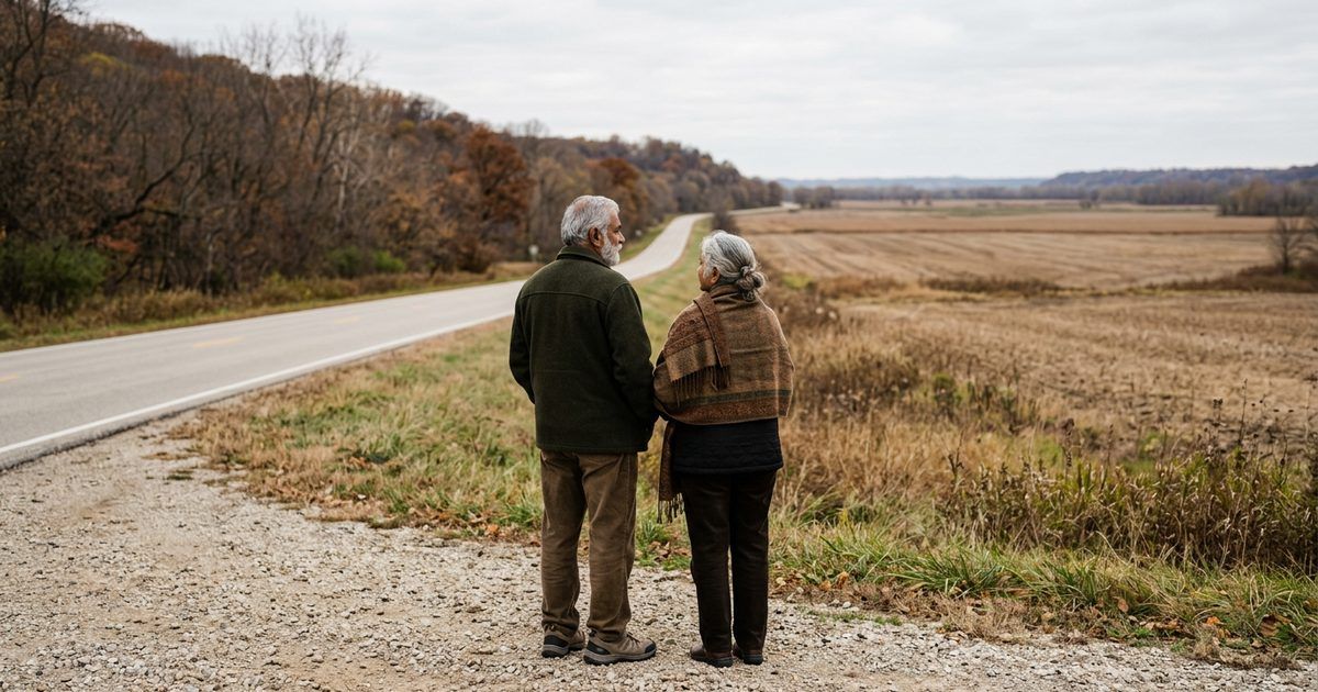
What is there to do on the Missouri side of the Great River Road?
Drive Highway 79. Say “Great River Road” in St. Louis and most people picture the Illinois bluffs. On the Missouri side it’s Route 79, which carries the Great River Road north from I-70 at the O’Fallon and St. Peters line, and Elsberry sits about 29 miles up it. The northern 30 miles of the route form the Little Dixie Highway of the Great River Road, a National Scenic Byway since 2002, and Ted Shanks is one of its listed stops.
Here’s the run, with nothing on it you’d find on a postcard rack.
The oldest plant materials center in the country, by its own account. The USDA’s Elsberry Plant Materials Center, established in 1934, sits on Highway 79, and an NRCS brochure calls it “the oldest Center in the nation.” Its 243 acres are a working research station that has developed more than 80 conservation plants for Missouri, Illinois and Iowa, among them big bluestem, sideoats grama and pale purple coneflower. It isn’t set up as an attraction, so don’t count on a tour. If you want to ask about one, call 573-898-2012 first.
A native-plant nursery you can shop. Forrest Keeling Nursery’s garden store, at 88 Forrest Keeling Lane, is open to the public Monday through Saturday. Its website lists 8 a.m. to 4 p.m., and its Facebook page has shown a later close, so check before you go. The nursery says it grows more than 250 species of native trees and shrubs, and it calls itself the largest producer of native plants in North America. It was also a partner on the 2001 wetland deal that added 2,900 acres to B.K. Leach. Fall is planting season, which makes October a good month to fill the trunk.
The wildlife string. B.K. Leach south and east of town, the refuge about 10 miles north, Ted Shanks about 45 road miles north. That’s nearly 14,800 acres of public wetland and woods along one highway, and you don’t pay to get into any of it.
The view. Stop on the hill in Elsberry and look east. The 1888 county history promised a view across the valley to the Illinois hills, and you can test that claim from the bench of the bluffs where most of the town still lives.
When the river rises. Route 79 runs close to the Mississippi, and floods in 2019 closed stretches of it. When the river is high, check MoDOT’s traveler map before you leave.
For the other bank, our guide to the Illinois side of the Great River Road from Alton to Grafton covers the bluffs and the ferry, and our roundup of scenic drives around St. Louis has more routes for a fall color day. To cross from here without driving to a bridge you need a boat, and our guide to ferries near St. Louis covers the Golden Eagle Ferry and the Winfield Ferry, the backup that runs when ice or high water closes the Golden Eagle.
What free things can you do in Elsberry?
More than you’d expect from a town this size, and most of it is history you can put your hand on.
The Old Calaboose. In the 200 block of North 2nd Street stands a limestone town jail, believed to date from about 1896. It replaced a wooden one that burned after a prisoner set newspapers on fire to get attention and nearly died before anyone let him out. According to the town’s history, the stone came from a quarry on the old Page Branch Road run by two African-American brothers, Ira and Tom Smith, and it was hauled into town on a sled pulled by oxen. Each block is 36 inches long and 17 inches on a side. Inside you’ll find one iron-barred cell and a potbellied stove. Only four or five calabooses are left in Missouri, and this one made Missouri Preservation’s Places in Peril list in 2015. A 2019 visitor guide listed it as free to see from dawn to dusk. The Elsberry Historic Preservation Society opened its museum next door free during this year’s Fall Festival, so watch its page for the next open day.
Cannon’s grave. Elsberry City Cemetery. Stand there a minute and picture 4,000 people and two presidents in a town this size.
Page Branch Park. The city’s newer park, on 5th Street, has a walking trail, a playground and a pavilion. It takes its name from the same creek the calaboose stone came out of.
A rainy-day plan. The Joseph R. Palmer Family Memorial Library is at 502 Broadway. Its posted hours don’t match across its own pages, so check current hours before you go. On a weekday, the refuge visitor contact station’s flyway exhibits are free and dry. And The Pickle Barrel, at 401 Broadway, keeps pinball and arcade machines next to its ice cream counter, which is the best way we know to end a cold morning on a levee.
The town calendar. The Elsberry Fall Festival lands on the first Saturday of October at City Park on Broadway. The 74th ran on Oct. 3, 2026, so expect the 75th on the first Saturday of October 2027, and check dates. Christmas in the Park ran on Dec. 6, 2025, with Santa from 3 to 4:30 p.m. in the Methodist Church Hall, a 5 p.m. parade and vendors. The 2026 date hasn’t been posted, but it’s usually early December, so check the city’s page. In summer, the Elsberry Community Growth Association runs free concerts at First Mid Park, 402 S. 4th St. The 2026 series, its ninth, played June 13, July 3 and Aug. 8 from 6 to 9 p.m. Bring chairs. The 2027 dates haven’t been announced.
Heading home? Highway 79 drops you back on I-70 at the O’Fallon and St. Peters line, and if there’s daylight left, our list of free things to do in O’Fallon, MO is right on the way.
Next time someone tells you eagle season means Illinois, you’re the one who knows whose name is on the refuge sign, that the 2022-23 survey, the latest posted, counted 77,076 ducks there on one December day, and that a snow goose flock can come and go in a week. Check the survey page. Call the refuge. Then drive north.
After a cold morning on the refuge auto route, our guide to where to eat in Elsberry, MO covers the warm-up stops on Broadway and North Main.
If you run a bait shop, a guide service or a Broadway storefront that birders and duck hunters pass on Highway 79, list it with us so they find you before they head home.
Frequently asked questions
How far is Elsberry, MO from St. Louis?
About 58 road miles from downtown St. Louis, which happens to match the 1888 county history’s figure of “fifty-eight miles north” by rail. The usual route is I-70 west to Highway 79, then about 29 miles north on 79 from the O’Fallon and St. Peters line. Plan on more than an hour from downtown, and check your map app for traffic before you leave.
What time of year do snow geese migrate?
In Missouri, fall through late winter. At Clarence Cannon National Wildlife Refuge north of Elsberry, the 2022-23 survey, the latest season the agency has posted, found the first 2,000 snow geese on Nov. 29, 2022, then 7,000 on Dec. 19, 2022, and a peak of 30,000 on Feb. 13, 2023. MDC calls them a common migrant and an uncommon winter resident. They spend the winter in the southern part of their range, Missouri included, and nest on the Arctic tundra from Nunavut east to Hudson Bay.
Is it rare to see a bald eagle in Missouri?
No. MDC lists the bald eagle as a common winter migrant and counted more than 600 active nests statewide in 2025. That’s a long way from the early 1960s, when the whole Lower 48 was down to 417 nesting pairs. From 1981 to 1990, MDC and its partners released 74 young eagles to rebuild Missouri’s nesting population, and it still lists the bird as a species of conservation concern. For the best odds near Elsberry, go from late December through early February, early in the morning.
What is not allowed in National Wildlife Refuges?
It depends on the refuge, because each one allows only uses that fit its purpose. At Clarence Cannon, the posted rules ban camping and fires, ATVs and UTVs, alcohol, target shooting, and collecting shed deer antlers, mussels, clams, crayfish, frogs or turtles. Dogs must be on a leash, and lands close a half hour after sunset. Fishing is by boat only in Bryants Creek and the Mississippi and its side channels, and gas motors are banned everywhere except Bryants Creek. Berries and mushrooms are fine for your own table.
Is a national wildlife refuge the same as a national park?
No. A national wildlife refuge is run by the U.S. Fish and Wildlife Service for wildlife first, and every activity has to fit the reason the refuge exists. Clarence Cannon was set up in 1964 as a feeding and resting area for migratory birds and bought with duck stamp money. It charges no fee and allows no camping. Visitors get an auto route, a nature trail and a weekday visitor contact station instead.
Can you camp anywhere on conservation land in Missouri?
No. On Missouri Department of Conservation areas, camping is allowed only where the area’s page lists it. Ted Shanks Conservation Area has designated camping sites, while at B.K. Leach, just below Elsberry, camping is prohibited. Where it’s allowed, you can stay 14 consecutive days in any 30, and no more than 30 days a year across all MDC areas without a special use permit. Quiet hours run from 10 p.m. to 6 a.m., and groups of more than 10 need a permit.
Where are the best duck hunting conservation areas in Missouri?
We won’t rank them, since a good season depends on water and weather. Here’s what we can tell you. MDC runs managed wetland areas with a daily morning draw, and two of them are near Elsberry. B.K. Leach and Ted Shanks are both on MDC’s list of 19 areas where waterfowl hunting on designated portions ends at 1 p.m., hunters need a Daily Waterfowl Hunting Tag, and the areas close to waterfowl hunting on Dec. 25. Nontoxic shot is required on both. Hunting at Clarence Cannon refuge follows refuge and state rules.
Where does Great River Road start and end?
It follows the Mississippi from Minnesota to the Gulf of Mexico through 10 states. North of St. Louis on the Missouri side, it rides Highway 79 from I-70 at the O’Fallon and St. Peters line, past Elsberry, and its northern 30 miles form the Little Dixie Highway of the Great River Road, a National Scenic Byway since 2002. Across the river near St. Louis, the Illinois route follows the bluffs from Alton to Grafton.

Written by a dedicated team of St. Louis locals who live, work, and play right here in the St. Louis metro. Founder Lane Forman and team are committed to building the region’s most trusted directory by verifying listings and connecting local businesses with loyal customers across Missouri and Illinois.